 Transportation
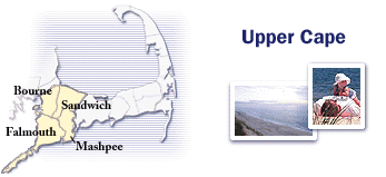
Sandwich, a central Upper Cape community, is approximately 58 miles from Boston.
How to get to the Upper Cape
From Boston and points north, the main route approaching the Cape is Route 3. This highway leads to the Sagamore Bridge. Travelers from the South and West access the Bourne Bridge after traveling on Route 25. Both bridges cross the Cape Cod Canal.
Ferry schedules
Door-to-door directions
Map with alternative routes
Getting around
Cars entering the Cape travel on either Routes 3 or 25. Inside the Cape, Route 6 is the dominant roadway. The most southerly route along Nantucket Sound is Route 28. (Routes 6, 6A and 28 eventually merge in the Lower Cape at the Orleans Rotary into Route 6, which travels north to Provincetown.)
Map of Cape roads
Create map of specific spot
Current traffic
Conditions on Routes 3, 6, 28
Sagamore Bridge live camera
Bourne Bridge live camera
Community information links
Bourne, Sandwich, Wareham |
Falmouth |
Mashpee
|