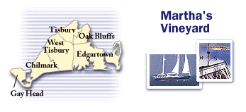
 Bike trails
Oak Bluffs to Chappaquiddick Island (15 miles)
This bike trail starts at Town Beach and heads east to a narrow spit of land formed by the Atlantic Ocean
on the left and Sengekontacket Pond on the right. This magnificent piece of coastline stretches 7 miles.
As the scenery transforms from ocean front to Greek Revival houses, the community of Edgartown makes
itself know.
Follow Main Street until you reach the harbor, and board the small ferry to Chappaquiddick Island. Once on
the island, enjoy the tranquil surroundings and flat roadways along the 4-mile journey to Wasque
Reservation. The last half mile turns into a dirt road and requires some cautious maneuvering for a
bicyclist.
The east coast of Chappaquiddick is about 7 miles long, encompassing two wildlife reservations: Cape Pogue
(489 acres) to the north and Wasque Reservation (200 acres) to the south. Most of the area, including salt
marshes, tidal pools and cedar thickets, are accessible only by 4-wheel-drive vehicles. For the bicyclist,
the Chappaquiddick coastline is so immense that even a short stroll down the beach brings privacy.
Oak Bluffs to Gay Head (20 miles)
An incredible cross section of the Vineyard, encompassing bicycle trails, rolling farmland and
ocean views, can be seen along this route. To start your tour, go south on Barnes Road 1/2 mile
until you see the Manuel F. Correllus State Forest on your right. For the next 4 miles, enter a
world free of cars and mopeds as you sweep by fragrant pine trees and scrub oak barrens.
The bike trail ends at Old County Road, where you have three parallel roads to choose from: South, Middle
and North. I recommend taking South Road or Middle Road on the way out and return on North Road. South and
Middle Roads have more hills, but the ocean and farmland views are spectacular. North Road is flatter,
making for an easier return trip. If you choose to start on South Road, be sure to stop off at the Field
Gallery in West Tisbury Center. This outdoor gallery provides a playful display of large, white, humanistic
statues, frozen in a favorite dance step.
All three roads end at Chilmark Center, where the Corner Way Restaurant and Deli, and Chilmark Store are
located. Either establishment contains a wide assortment of lunch choices. Once stocked up with food, your
journey to Gay Head lasts only 5 more miles. (Ed Note: The restaurant is no longer there, but the store has
a deli. And be sure to stop at Chilmark Chocolates for a mighty nice treat!)
The last stretch of road sweeps up and down rolling terrain, sandwiched by spectacular ocean views. Take
a left on Moshups Trail Road. Pedaling around the last curve, the road collides with barren sand dunes and
travels along the ocean edge. The end to the day's journey is near as the cliffs of Gay Head become larger
and colors more distinct with each stroke of your pedal.
Information courtesy Martha's Vineyard Chamber of Commerce.
|